Region 3
RGPS Images
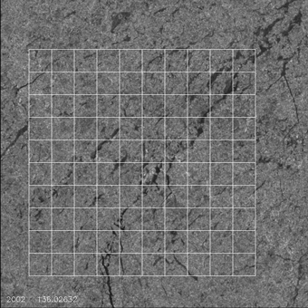
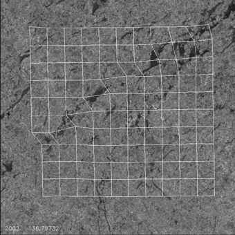
A grid is placed on satellite images of artic ice. The deformation of the
ice is visualized by following the vertices of the grid in time. New ice
appears dark in the images; therefore new dark areas correspond to leads
that have appeared.
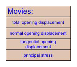
View divergence, vorticity and shear for this region
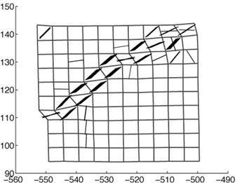
Numerical Predictions (Kinematics)
The observed deformation from each element of the above satellite images is used as input
into the decohesion constitutive model. The figure below shows the lead
opening predicted by the model. Dark patches represent leads; the thickness
of the patch is proportional to the amount of opening. Click on an element to
see details of the numerical results.
Return to:
Sea Ice Page
Deborah Sulsky's Research Description
Deborah Sulsky's Homepage
Department of Mathematics and
Statistics,
University of New Mexico.
Last updated: November, 2003
Copyright © 2003, Deborah Sulsky